The Greenbelt, Satellite Cities and Transportation
in Ottawa.
Before I go into explaining the merits of the Greenbelts and Satellite cities I feel that it is important to outline the major difference between a concentric city and a multi-node city. I am doing this because it is quite apparent that much of the planning that is being for Ottawa is based on a form of city that no longer exists. I.e. the Concentric City.
The following is taken from chapter four from the Introduction to Real Estate as a Professional Career manual:
[Start Quote:]
Concentric Circle Theory
Urban economists have generally concentrated on what makes cities grow, what shape that growth takes and the consequent complex interactions that give rise to land use patterns, densities, location of residential versus commercial developments and transportation systems. Urban economics, as we know it today, began with theorists postulating on patterns of urban growth. The most notable, based on the 1920’s work of Ernest Burgess, a respected urban sociologist from the University of Chicago (born in Tilbury, Ontario), described urban growth in terms of concentric circles emanating from a central business core. Burgess conceived of a model that contained five zones: the central business district (CBD), transition zone, working class homes, middle and higher income residential, and suburban.
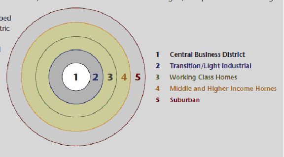
Source: Real Estate as a Professional Career.Chapter 4, Page 124. 2011 Edition. Real Estate Council of Ontario. 3250 Bloor Street West. Suite 600, East Tower. Toronto
MultiPle Nucleii theory
Subsequent urban economists would further refine these models by moving away from the one CBD (the monocentric city) to address the growth of suburban core commercial areas and resulting realignment of traffic patterns, densities and land usage to accommodate these relatively independent suburban subpoints of economic activity. Each successive model seemed to be a refinement based on the era in which it was developed. Certainly, Burgess’ concept worked for city growth in the early 1900’s but later models provided successively better ‘fits’ as cities became more complex and urban economists sought further theoretical refinements. Interestingly, most modern cities typically display components of all four models with multiple nuclei having the best fit for large centres; i.e., the Greater Toronto Area. Numerous models have been developed based on these four primary theories but such discussion goes beyond the scope of this discussion.
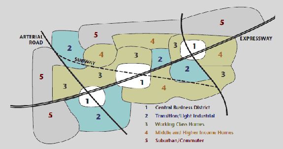
Source Real Estate as a Professional Career.Chapter 4, Page 125. 2011 Edition. Real Estate Council of Ontario. 3250 Bloor Street West. Suite 600, East Tower. Toronto,
[End Quote]
Ottawa is a Multiple Nucleii city!
The city of Ottawa is not a concentric city, but rather it is more of a Multiple Nucleii city with multiple central business districts and multiple zones of transition and light industrial zones. As well, Ottawa is also a region that includes the three satellite cities of Kanata Barrhaven/Nepean South And Orleans. These Multiple Nucleii zones were further multiplied with the formation of the new City of Ottawa, which was created by the amalgamation of all of the cities, and townships that once comprised the area formerly known as the Regional Municipality of Ottawa-Carleton.
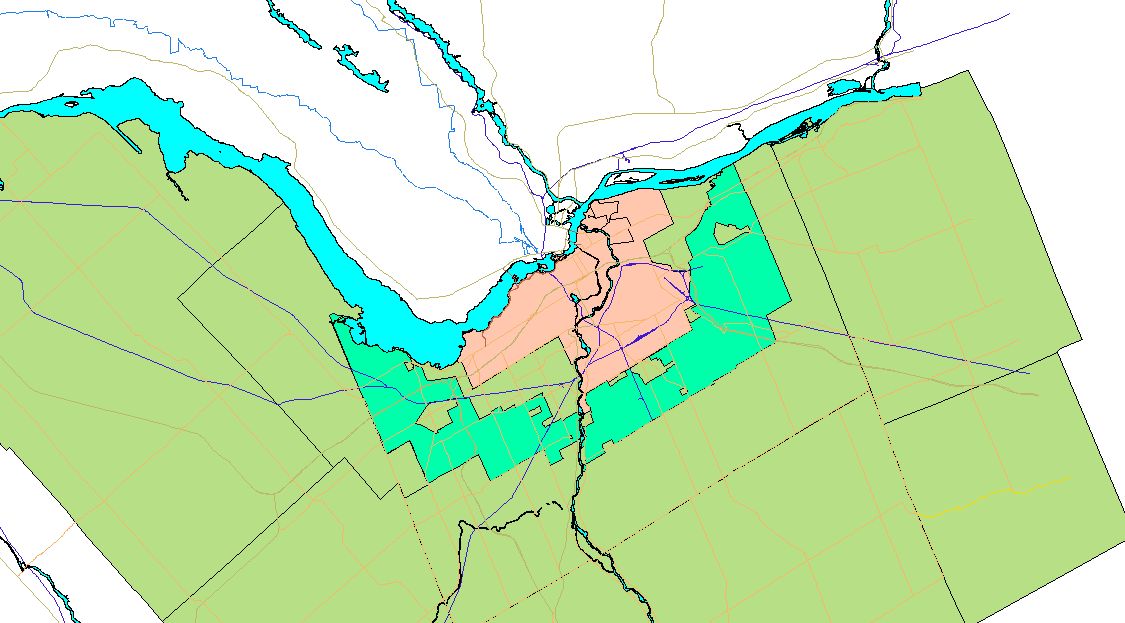
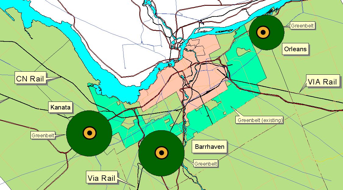
I made a map to show the layout of the City of Ottawa showing its Greenbelt as well as the location of the major employment zones. The employment zones are shown as pink tones. And it is shown below.
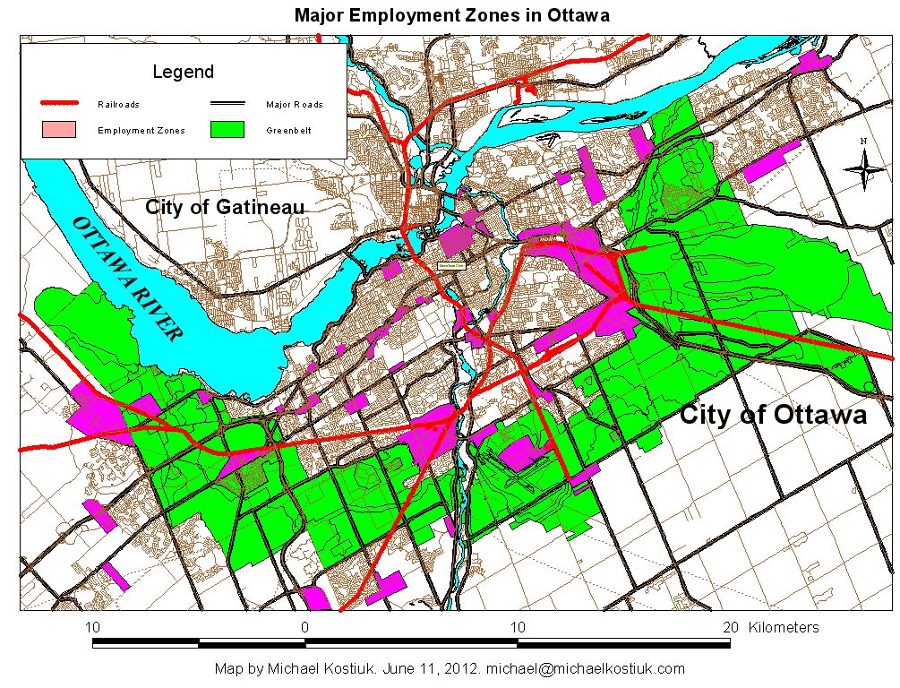
It is obvious by viewing this map that the city of Ottawa is a Multiple Nucleii city with multiple employment and commercial zones. Please note that these employment zones are distributed all across the city of Ottawa, and they are located both inside and outside the Greenbelt. The downtown core of Ottawa is simply one zone of many employment zones located through out the city of Ottawa. Although the City of Ottawa once a Concentric city in the 19th and early 20th centuries, it gradually changed to a Multiple Nucleii city after world war two. In fact many cities in North America also went through the same type of urban change as is seen in Ottawa. The proliferation of the business parks that are located outside the Central Business District of most major sized cities is a significant part of this change in the form of modern North American cities from their original concentric design. And what may be quite surprising to many people is that only 19% of the people in Ottawa currently work in the downtown core. The Source of this information comes from the City of Ottawa’s own Demographics Report. "Employment in Ottawa. Results of the 2006 Employment Survey. Date. November 2007. Publication # 10-12".
In fact, the NCC (National Capital Commission) purposely set out to design Ottawa with “dispersed employment zones” away from the downtown core of the city. The following information about the NCC’s planning for dispersed employment zones in Ottawa comes from an article in the Ottawa Journal dated 1961. The complete article is in Appendix 1a.
“Speaking on "Railway Relocation Plans for Ottawa" before an Engineering Institute of Canada meeting Thursday night, Eric Thrift, NCC general manager, said the redevelopment of land vacated by the railways "opens up new possibilities and poses many problems."
Towards the end of the article there is a quote about the NCC‘s vision and planning regarding the employment zones in the City of Ottawa:
“In answer to a question on the disappearance of downtown rail lines that the questioner thought could be used for commuter transportation in the future, Mr. Thrift said Ottawa was being planned on a dispersed technique."
By this, he explained, he meant that there would not be the daily rush of commuters to the downtown areas now experienced by larger cities.
Source: Ottawa Journal, Friday 21 April 1961, Page 25.
The complete article is shown at the end of this page in Appendix 1.
Ottawa's Greenbelt and Satellite Cities.
As well as being a Multiple Nucleii city, Ottawa is a special and unique city in Canada since it has many unique attributes. It is the national capital of Canada; it is part of the National Capital Region that straddles the Ottawa River. While the City of Ottawa is solely in Ontario, the National Capital Region occupies portions of the Province of Ontario and the Province of Quebec. And as well as having it's own municipal government the region is also partly managed by the province of Ontario and National Capital Commission. The city also cooperates with the City of Gatineau on the Quebec side of the Ottawa River on various planning, transportation and other issues.
The Greenbelt.
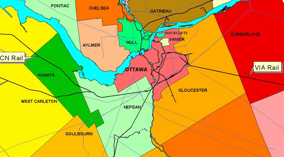
Over the years the various local, provincial and federal governments have greatly changed and modified the design and complexity of this region. One of the earliest attempts at managing and controlling future growth was through the creation of the Greenbelt. This is a collection of lands that surrounds the central urban core The greenbelt extends from approximately Kanata in the west to Barrhaven and Riverside in the south and to Orleans in the east.
The map below shows the region before the introduction of the Greenbelt
The purpose of a Greenbelt in urban and regional planning is to contain urban growth from sprawling uncontrollably. The further a city grows away from its centre the more difficult and more expensive it is to provide services to provide transportation and public transit systems. Along with the greenbelt new growth is directed to new cites which are often called "Satellite Cities". These cities are located on, or near existing and active rail lines, and they are designed to have: a mix of employment, a mix of housing styles as well as having a sufficient number of schools, playgrounds, parks and community facilities.
The main idea of this new style of urban growth was to design and build new cities without all of the problems that were inherit with the older, congested, and dirty cites.
The is not a new concept since urban planners have been using these things since the middle of the 20th century. The modern geography of Ottawa with its greenbelt and it existing communities of Barrhaven, Kanata and Orleans is a legacy of this style of urban and regional planning.
Here is a link to a short animated movie on the Internet archives site: New Town 1948.
It is a British government information film that describes the concept of greenbelts and satellite cities. It does an excellent job of explaining why we have greenbelts and how they "should work", however, the film is definitely "anti-high rise" development. Please watch it and then come back to this site to continue reading this page. It is a fun movie to watch.
Comments about Satelite Cities around Ottawa by Professor David L.A. Gordon
Note: According to Professor David L.A. Gordon (who teaches Urban Planning in the School of Urban and Regional Planning at Queen’s University), he recently stated that the concept of a satellite city outside a Greenbelt is still useful, but to be effective in the 21st century the following modifications need to be made:
- Clustering of employment requires networks of high-speed transit to connect each cluster, and to places where people live.
- Satellite city employment with employment clusters works best with ONE Parent working (As in the British Satellite city model). The model is not as efficient if two spouses are working and one does not work in the satellite city. Therefore, there needs to be access to a network of high-speed transit that connects the various satellite cities with the MAIN URBAN CENTRE.
Professor Gordon said that when the satellite city design was being implemented in the Ottawa area, the urban growth occurred so quickly and beyond what was originally estimated (mostly due to post world war two baby boom and immigration) that the planners were not able to keep up with the demand for housing. So instead of designing proper satellite towns with higher density, and a sufficient employment base, most of the planning was done to simply allow the creation of quick and low density housing suburbs to be located just beyond the Greenbelt in places like Orleans. So with some exceptions like the north sector of Kanata (which was planned correctly according to 1950s methodology), we got bedroom communities instead of fully functional satellite cities.
The map shows the location of the greenbelt
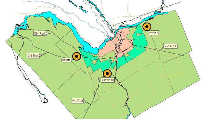
To contain urban sprawl and to direct new growth, three major "Satellite Cities" were planned for Ottawa. These cities were to be built OUTSIDE the greenbelt, and ideally they should have their own employment centre's so that the majority of its residents would be able to both LIVE, AND WORK in those new communities. It was important that those new communities be placed near to existing and future rail lines and road systems.
The following simplified map shows the location of Kanata in the West, Barrhaven in the south and Orleans in the east.
Note the location of rail lines near all three of the satellite cities.
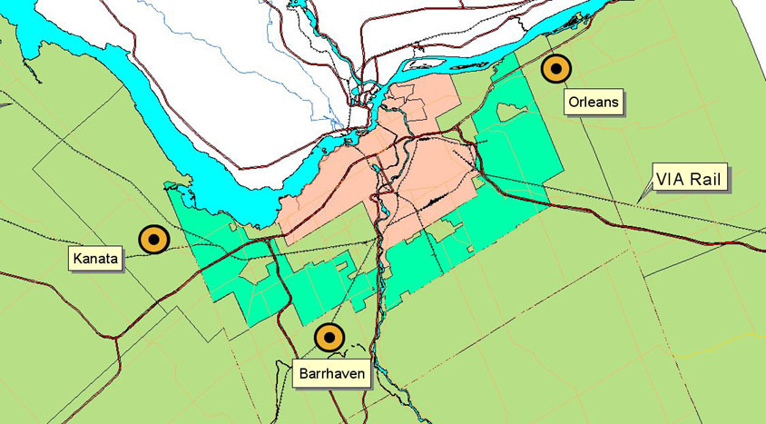
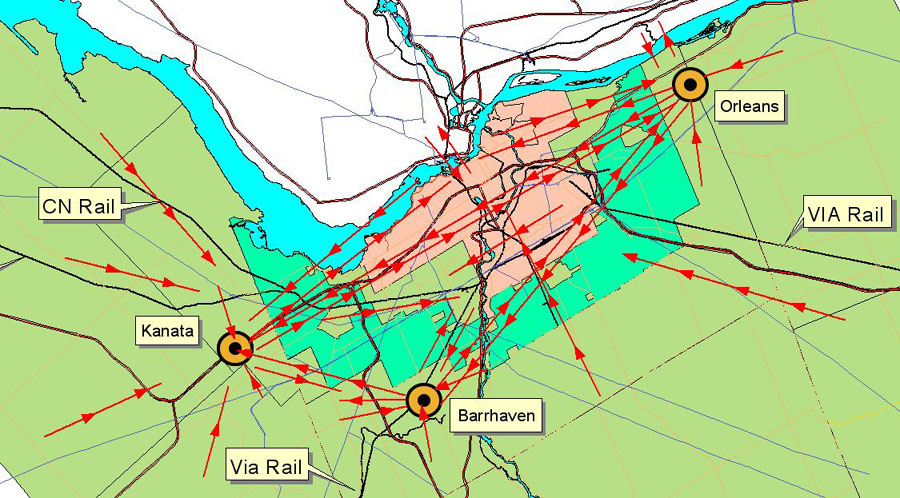
This map shows the location of major roads in the Ottawa Region
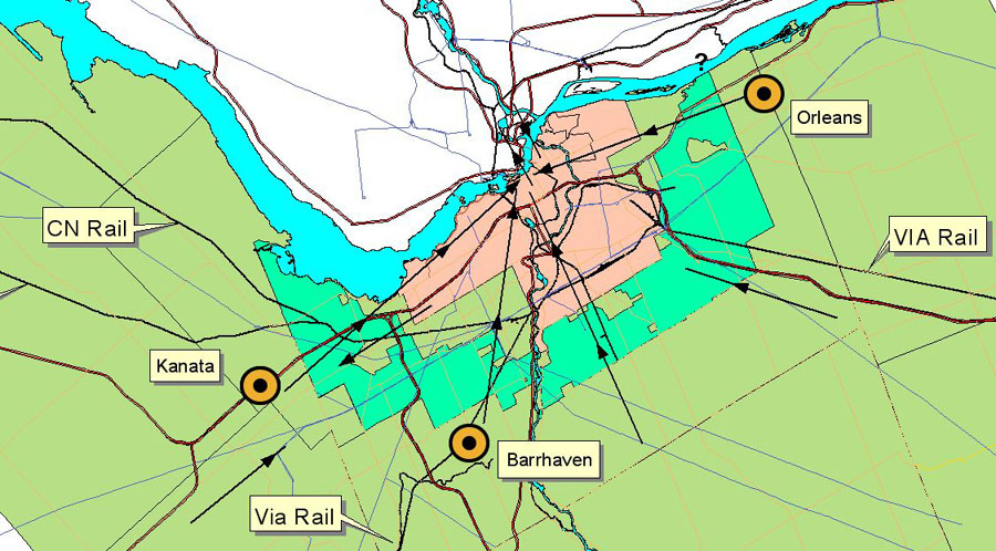
This maps shows an approximation of current transit flows in the Ottawa Region.
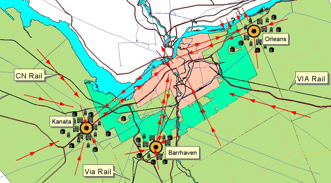
This map shows a simplified version of the three satellite cities with their own greenbelt systems
If we follow the intent of the original design of the satellite cites for the Ottawa Region there will eventually be major employment centres located near the centre of the three satellite cites. Along with a mix of affordable low, and medium density housing, these satellite cites will be places where people can both live and work in. Therefore, the need to provide transportation to the core city of Ottawa will be greatly reduced since many people will be living NEAR where they work.
This map shows a more balanced system of satellite cities outside of the greenbelt. Note that transit is going to the satellite cities as well as to the core of the city.
Transportation will also be dual or multi-directional since in reality not everyone will live where they work. Therefore a gird system of Public Transit will be necessary since not everyone will want to go through the core of the city in order to get to their destinations. Use will be made of existing rail corridors to move people across the region. In some ways this is ideal since in the present situation transit buses carry people from the areas outside of the greenbelt to the core of the city and return mostly empty to the suburbs to restart their transit runs. In the future these buses or light rail trains (including commuter trains) will be carrying people in both directions, and this means that they will be generating transit revenue in both directions of their runs. i.e. No more dead heading routes! This will result in a more cost effective and energy efficient operations. In this scenario a transit tunnel under downtown Ottawa may not be necessary since transit flow to the core may actually remain stable or even decrease. Add the factor of an increased amount of people entering the retirement age, which will result in a smaller percentage of the population commuting to work each day. Since there will be more retired people using transit during the off-peak hours of the day, the transit systems will need to be designed to accommodate these off-peak users. This is where a grid system of transportation will be essential. Use of privately run rural-based transportation networks that link into the Ottawa transportation system will be required to make off-peak transit use efficient and cost effective. I then propose that city of Ottawa eliminate its transit monopoly outside of the greenbelt so that private operators can provide transit services that the City of Ottawa is unable to provide. Or at the very least to provide a mechanism where private transit operators can be contracted to provide such as service. I have seen these rural transit systems work in many European countries and it provides a very useful link between the rural and urban areas. Remember that Ottawa is 5/6 rural and 1/6 urban! Such a service will allow rural-based elderly people to remain in their homes if they lose the ability to drive their cars. For more information on the benefits of rural transit please read my report on rural transit on my home page. Rural Transit Symposium, November 19, 2009.
This map show what a multi-directional transit system might look like when the three satellite cities are places where people both live and work in.
The following is a brief example of New Urbanism and how this type of integrated planning, design and devlopment can be used to build viable and livable town centres in Ottawa's Communities that are OUTSIDE the Greenbelt.
New Urbanism
So what is it?
It is basically a return to many of the designs and theories behind the car-less communities of the Victorian era.
New urbanism is a planning movement that promotes "walkable, neighborhood-based development as an alternative to sprawl."
The Congress for the New Urbanism is the leading organization that promotes the New Urbanism practice, and many of its principles guide the development of New Urbanism and its application.
From Wikipedia
http://en.wikipedia.org/wiki/New_Urbanism
New Urbanism is an urban design movement, which promotes walkable neighborhoods that contain a range of housing and job types. It arose in the United States in the early 1980s and continues to reform many aspects of real estate development and urban planning.
New Urbanism is strongly influenced by urban design standards prominent before the rise of the automobile and encompasses principles such as traditional neighborhood design (TND) and transit-oriented development (TOD).It is also closely related to Regionalism, Environmentalism and the broader concept of smart growth.
New urbanists support regional planning for open space, context-appropriate architecture and planning, and the balanced development of jobs and housing. They believe their strategies can reduce traffic congestion, increase the supply of affordable housing, and rein in urban sprawl. The Charter of the New Urbanism also covers issues such as historic preservation, safe streets, green building, and the redevelopment of brownfield lands.
New Urbanism for Ottawa.
New Urbanism techniques allow us to modify existing built environments such as Shopping Centres and Big Box Malls into town centres.
Walk-able main streets are one the main features of New Urbanism, as well as the emphasis on public transit. In order to create viable main street environments in suburban areas there needs to be spaces to create a mix of employment, shopping, services, transportation and housing in close proximity to each other. Essentially this is the creation of new town centres. But unlike many of the so-called newly built town centres that we see today, the New Urbanist Town centre looks very much like a traditional main street environment that we find in the older parts of the central city such as in the Glebe and Ottawa South. New Urbanism takes a positive approach to suburban sprawl such that they consider it to be simply stage one of a multi-stage process to create viable walk-able communities in “the suburbs”. In Ottawa’s case I am referring to the often-referred suburbs of “Kanata”, “Barrhaven” (South Nepean) and “Orleans”, which were originally designed, to be satellite cites, and not just suburbs beyond the Greenbelt. With the exception of Kanata, Ottawa’s Satellite cities are not functioning as places where people both live and work. They lack a walk-able “town centre” in the traditional sense, and far too many of their residents commute across the Greenbelt to work in the cities of Ottawa or Gatineau.
The following table divides the population of Ottawa by employment to get a percentage. If you then apply this percentage to the Satellite Cities and Urban centres outside the Greenbelt to determine how many people should be employed in those areas the result is as follows:.
CITY Ottawa Greater Ottawa-Gatineau
YEAR 2006 2031 2006 2031
Population 870,800 1,135,800 1,307,100 1,733,800
Jobs 529,800 703,100 742,700 1,008,300
Percent 60.84 61.9 56.82 58.16
Divide Ottawa 2006 and Ottawa 2031 by 2 we get an average population percentage of 61.37%
Therefore based on the average of 61% the following communities SHOULD have workforces of the following:
Note: Suburbs will have many younger people living there as opposed to the older neighbourhoods, so this will not be 100% accurate, but it will give a fairly good picture of the POTENTIAL local employment of the three Satellites cities outside the Greenbelt.
City/Population Actual Expected Difference
Employment Employment
Orléans/94,980 17898 or 18.84% 57937.8 - 40,039.8
Kanata/67,100 39002 or 58.13% 40931 - 1,929
South
Nepean/ 54,950 6982 or 12.7% 33519.5 - 26,537.5
Riverside
South / 6,840 629 or 9.2% 4172.4 - 3,543.4
Stittsville /18,950 4638 or 24.48% 11559.5 - 6,921.5
Letrim 1,235 2158 or 174.74% 753.35 +1404.65
If you refer to the above table you will see how the employment rate is much lower in Orleans and South Nepean than it is to the Ottawa average. I have highlighted this is red to make it more visible.
To create a more balanced employment rate throughout the region MORE employment needs to be directed to Orleans and South Nepean. Using new Urbanist techniques we can take small portions of the parking areas that are allocated to their suburban Shopping Centres and Big Box Malls that are located along the main road ways, and use that space for the construction of office towers. At the base of these office towers, stores and services are located. Wide sidewalks are built in the front of these office towers and the main streets upon which they are situated can either have on-street parking and/or dedicated lanes for public transit. Greenery and street furniture are placed on the sidewalks to create a pleasant walking environment. The end result is a main street that has employment, shopping and services in a very condensed area. Housing such as apartments can also be incorporated into the main street environments, and these can link to lower density houses further away from the main street. The Shopping Centres themselves will benefit from this development since there is a larger pool of potential shoppers in the area. Since employment is now located near where people live, use of cars will drop, and people will more able to use public transit, or to even to walk, or bike to work. The result will be less travel time and more personal and family time. This creates a more sustainable community, and reduces the need to provide transit services across the Greenbelt. It is cheaper to do this than to build expensive Rapid Transit Systems since it can be done by the private sector.
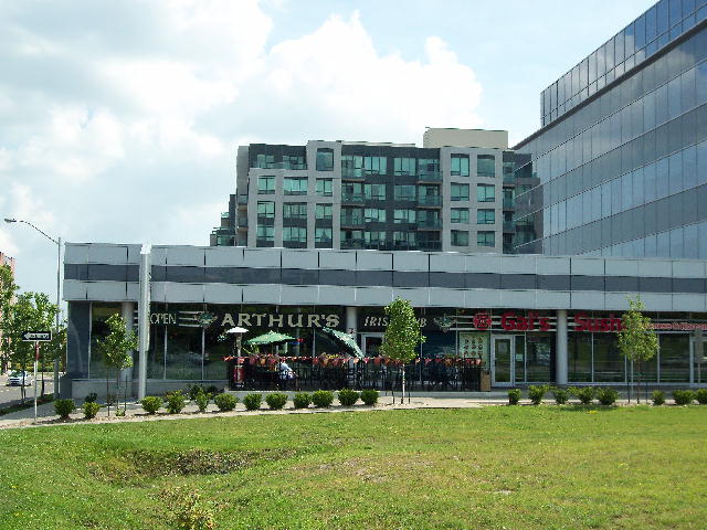
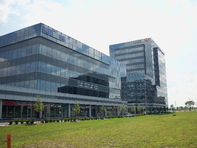
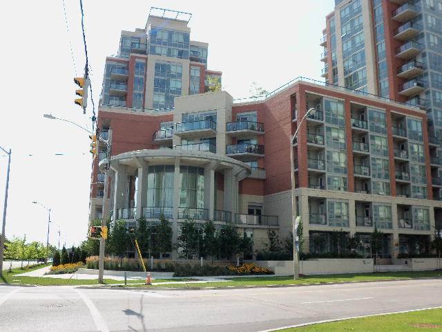
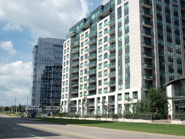
The following images are of Liberty Square at the corner of Town Centre Road and Highway 7 in Markham Ontario. This is a cluster of office towers and apartments/condominiums with stores and services on the ground level. The buildings are also offset from the roads which give pedestrians a pleasant walking experience away from the nearby traffic. It is not a perfect (or textbook) example of New Urbanism, but it has many of the features that are described above.
Michael Kostiuk
Appendix 1.
NCC Explains Rail Relocation
The Ottawa Journal of Friday 21 April 1961, Page 25, contained the following report. It suggests that the NCC did not intend to abandon its role in setting policy for the Ottawa terminal Railway to the two railways.
It also has a curious explanation why Ottawa would not need to retain downtown rail lines for commuting. Neither statement appears to be valid, as indicated by my comments, which follow the report.
Thrift Explains Rail Relocation
Union Station Area.
A Unique Challenge
Ottawa may be unique among North American cities for its redevelopment of large downtown areas made possible by the relocation of railway facilities.
Speaking on "Railway Relocation Plans for Ottawa" before an Engineering Institute of Canada meeting Thursday night, Eric Thrift, NCC general manager, said the redevelopment of land vacated by the railways "opens up new possibilities and poses many problems."
He cited the construction of the western part of the Queensway along the old CNR Renfrew line as an example.
22 ACRES
He explained that plans to relocate Union Station and the CNR freight sheds near Hurdman Road East of Alta Vista Drive would leave 22 acres in the middle of the city for NCC use. (Union Station and the area South, now taken up by CNR yards.)
"If we capitalize on this opportunity to redevelop this area it will be unique in North American cities, and especially good for the capital if we can do it well - that's important - if we can do it well," he said.
"Possibly no other city has an opportunity like this to take over and redevelop such a large part of its area right down town," he added.
PARKWAY DEVELOPMENT
He also explained how removal of the CPR yards at Nepean Bay bounded by Wellington and Broad Streets plus the removal of the CPR Carleton Place line along the Ottawa River - and its many dangerous level crossings - would make way for further development of the Ottawa River Parkway and the Queensway.
"Although the Carleton line has many bad crossings and there are many complaints about it, the railway will still have to use it for some time," he said.
SIDE BY SIDE
CPR freight sheds will be located along side the CNR sheds.
Both CNR and CPR marshalling areas are to be built South of Walkley Road.
The CPR line from Sussex Drive along the East side of the Rideau River to Alta Vista Drive will also be removed according to the NCC plans.
With the present Union Station removed the railway across Alexandra Bridge will be unnecessary and the problem of how best to utilize the bridge will be "on our hands," he said.
STILL UNDECIDED
It has not been decided, he said, whether to "depress or elevate the CPR Prescott line (running through Carleton University campus) but the NCC favours putting it down in the ground."
On a large map illustrating his talk, Mr. Thrift showed a line encompassing the city, inside of which he said would operate a CNR-CPR terminal company. Although wholly owned by the railways, the NCC would have a say in policy.
PROBLEMS
He also touched on the multiple and individual problems of industrial relocation to coincide with railway plans.
"The NCC has begun an industrial subdivision near the new Union Station site, but industries located along discontinued lines such as the CPR Carleton Place line are problems yet to be dealt with," he said.
"The target date for completion of the scheme is 1965. By then 35 miles of track would be removed, 70 level crossings eliminated and 450 acres would be made available for industrial development," he summed up.
In answer to a question on the disappearance of downtown rail lines that the questioner thought could be used for commuter transportation in the future, Mr. Thrift said Ottawa was being planned on a dispersed technique."
By this, he explained, he meant that there would not be the daily rush of commuters to the downtown areas now experienced by larger cities.
END
You can contact Michael Kostiuk using the following methods:
-
Area code: 613 Phone: 324-5409
-
E-mail: michael@michaelkostiuk.com
-
Canada Post: Michael Kostiuk, Ottawa, ON, Canada. Postal Code:
K1Z 7M8.
Go back to Michael Kostiuk's Home Page.
Last Update: July 21, 2014.